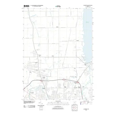
2010 Map of Champion
USGS Topo · Published 2010About this map
Champion and the surrounding Trumbull County landscape are defined by the convergence of industrial progress and quiet suburban expansion at the turn of the 21st century. The map highlights significant local institutions like the Kent State University Trumbull Branch, positioned near the expanding infrastructure of Educational Hwy NW. To the east, the massive reservoir of Mosquito Creek Lake and its corresponding Mosquito Creek Dam dominate the hydrology, alongside smaller features like Yount Pond. Genealogists will find a high density of burial grounds including Champion Center Cemetery, McMurray Cemetery, and the Saint Joseph Cemetery, providing a clear record of local settlement patterns. Residential clusters and smaller crossroads like Hoagland Corner, Morgandale, and Wilhelm Corner reveal the community's layout before further modern development, while the Mahoning River winds through the southwestern corner near Brookside Park.
Find a feature on this map
67 named features on this map. Tap any name to fly to it.
Don’t see what you’re looking for? This feature index may not catch every label — zoom into the map to look around manually.
Map Details
Editions of this 2010 Champion Map
This is the sole edition of this map. No revisions or reprints were ever made.
Other maps of this area

1905 · Bristolville
USGS Topo · 1:62,500

1906 · Youngstown
USGS Topo · 1:62,500

1907 · Kinsman
USGS Topo · 1:62,500

1907 · Bristolville
USGS Topo · 1:62,500

1908 · Youngstown
USGS Topo · 1:62,500

1908 · Warren
USGS Topo · 1:62,500

1950 · Cleveland
USGS Topo · 1:250,000

1952 · West Farmington
USGS Topo · 1:24,000

1952 · Southington
USGS Topo · 1:24,000

1954 · Girard
USGS Topo · 1:24,000