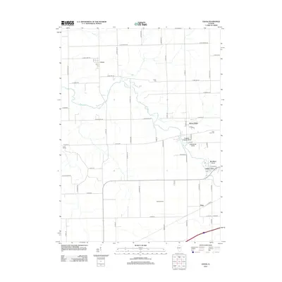
2012 Map of Chana
USGS Topo · Published 2012About this map
The Kyte River meanders across this rural landscape, serving as a primary geographic anchor for the small settlements and agricultural plots of Ogle and Lee Counties. The village of Chana sits in the northwest, marked by its Po and a network of named roads including E Honey Creek Rd and S Chana Rd. The area is characterized by a mix of traditional farmsteads and modern residential clusters, such as Hickory Ridge and Frahms Country-Acres, which have developed near the eastern boundary.
Find a feature on this map
57 named features on this map. Tap any name to fly to it.
Don’t see what you’re looking for? This feature index may not catch every label — zoom into the map to look around manually.
Map Details
Editions of this 2012 Chana Map
This is the sole edition of this map. No revisions or reprints were ever made.
Other maps of this area

1917 · Kings
USGS Topo · 1:62,500

1918 · Dixon
USGS Topo · 1:62,500

1918 · Kings
USGS Topo · 1:62,500

1922 · Oregon
USGS Topo · 1:62,500

1924 · Oregon
USGS Topo · 1:62,500

1950 · Dixon
USGS Topo · 1:62,500

1952 · Rochelle
USGS Topo · 1:62,500

1954 · Rockford
USGS Topo · 1:250,000

1955 · Rockford
USGS Topo · 1:250,000

1958 · Aurora
USGS Topo · 1:250,000