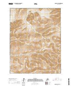
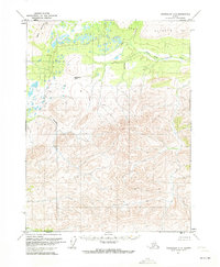
2017 Map of Chandalar A-5 SW
USGS Topo · Published 2017About this map
Siwash Cr meanders through the interior landscape of the Chandalar region in the Yukon-Koyukuk Census Area. This part of Alaska remains largely undeveloped, characterized by the Public Land Survey System divisions of Townships 25 through 27 North across Ranges 8 and 9 West. The contour data, provided by the National Elevation Dataset, reveals a terrain defined by significant elevation changes and drainage patterns that feed into the local creek system. While the region lacks formal road networks or established settlements on this sheet, the map serves as a primary record of the topographic structure and land boundaries as they existed in the early 21st century.
Find a feature on this map
7 named features on this map. Tap any name to fly to it.
Don’t see what you’re looking for? This feature index may not catch every label — zoom into the map to look around manually.
Map Details
Editions of this 2017 Chandalar A-5 SW Map
This is the sole edition of this map. No revisions or reprints were ever made.
Other maps of this area

1951 · Chandalar
USGS Topo · 1:250,000

1951 · Beaver
USGS Topo · 1:250,000

1956 · Chandalar
USGS Topo · 1:250,000

1956 · Beaver
USGS Topo · 1:250,000

1964 · Chandalar
USGS Topo · 1:250,000

1964 · Beaver
USGS Topo · 1:250,000
1970 · Beaver D-5
USGS Topo · 1:63,360
1970 · Chandalar A-6
USGS Topo · 1:63,360
1970 · Beaver D-6
USGS Topo · 1:63,360
1970 · Chandalar A-5
USGS Topo · 1:63,360