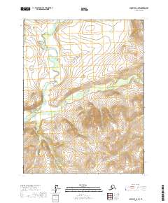
2017 Map of Chandalar A-6 SW
USGS Topo · Published 2017About this map
Eagle Cliff stands as a prominent landmark overlooking the confluence of the South Fork Koyukuk River and the Mosquito Fork. This 2017 survey reflects the remote interior of the Yukon-Koyukuk region, where the landscape is defined by its complex drainage network rather than human infrastructure. Several significant tributaries, including Hungarian Cr, Frisky Cr, and Granite Cr, wind through the townships of the Central Brooks Range foothills. The map provides a detailed view of these watercourses before they join the larger Koyukuk system, illustrating the natural hydrological patterns of the Alaskan wilderness. For those studying the geography of Northern Alaska, this sheet documents the precise topographical contours and waterway alignments of this unpopulated stretch of the interior.
Find a feature on this map
12 named features on this map. Tap any name to fly to it.
Don’t see what you’re looking for? This feature index may not catch every label — zoom into the map to look around manually.
Map Details
Editions of this 2017 Chandalar A-6 SW Map
This is the sole edition of this map. No revisions or reprints were ever made.
Other maps of this area

1951 · Bettles
USGS Topo · 1:250,000

1951 · Chandalar
USGS Topo · 1:250,000

1951 · Beaver
USGS Topo · 1:250,000

1951 · Wiseman
USGS Topo · 1:250,000

1956 · Chandalar
USGS Topo · 1:250,000

1956 · Bettles
USGS Topo · 1:250,000

1956 · Wiseman
USGS Topo · 1:250,000

1956 · Beaver
USGS Topo · 1:250,000

1964 · Wiseman
USGS Topo · 1:250,000

1964 · Chandalar
USGS Topo · 1:250,000