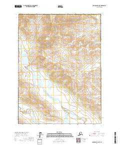
2017 Map of Chandalar D-3 NE
USGS Topo · Published 2017About this map
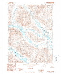
Your Creek defines the interior landscape of this 2017 survey, winding through the remote wilderness of the Yukon-Koyukuk Census Area. The map illustrates a high-latitude environment where the hydrology is primarily captured by the meandering path of this single waterway as it moves through township grids like t36n r3w and t35n r3w. The absence of named settlements, roads, or man-made structures highlights the undeveloped character of this region of Alaska, focusing instead on the precise topography and the natural drainage patterns of the Your Creek basin. This level of detail is particularly useful for understanding the exact elevations and landform orientations in an area defined by its seasonal wetlands and isolated water systems.
Find a feature on this map
8 named features on this map. Tap any name to fly to it.
Don’t see what you’re looking for? This feature index may not catch every label — zoom into the map to look around manually.
Map Details
Editions of this 2017 Chandalar D-3 NE Map
This is the sole edition of this map. No revisions or reprints were ever made.
Other maps of this area

1951 · Chandalar
USGS Topo · 1:250,000

1951 · Brooks
USGS Topo · 1:250,000

1956 · Chandalar
USGS Topo · 1:250,000

1956 · Philip Smith Mountains
USGS Topo · 1:250,000

1964 · Chandalar
USGS Topo · 1:250,000

1964 · Philip Smith Mountains
USGS Topo · 1:250,000
1971 · Philip Smith Mountains A-2
USGS Topo · 1:63,360
1971 · Philip Smith Mountains A-3
USGS Topo · 1:63,360
1990 · Chandalar D-2
USGS Topo · 1:63,360
1990 · Chandalar D-3
USGS Topo · 1:63,360