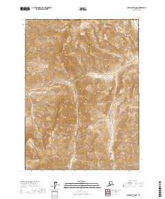
2017 Map of Chandalar D-6 NE
USGS Topo · Published 2017About this map
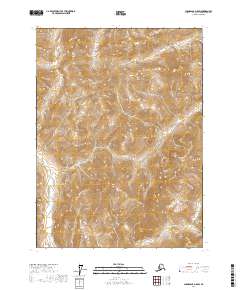
Table Mtn dominates the northern reaches of this topographic study, where steep ridgelines converge at the border of the Yukon-Koyukuk Census Area. The landscape is defined by the drainage of Nutuvik Creek, which winds through deep valleys in the southwestern quadrant. This 2017 edition reflects the modern surveying of the Alaska interior, detailing the intricate elevation changes across the t37n r10w, t37n r9w, t36n r10w, t36n r9w, t35n r10w, and t35n r9w land divisions. The terrain is a complex network of unnamed peaks and draws, punctuated only by the primary flow of Nutuvik Creek.
Find a feature on this map
10 named features on this map. Tap any name to fly to it.
Don’t see what you’re looking for? This feature index may not catch every label — zoom into the map to look around manually.
Map Details
Editions of this 2017 Chandalar D-6 NE Map
This is the sole edition of this map. No revisions or reprints were ever made.
Other maps of this area

1951 · Chandalar
USGS Topo · 1:250,000

1951 · Brooks
USGS Topo · 1:250,000

1956 · Chandalar
USGS Topo · 1:250,000

1956 · Philip Smith Mountains
USGS Topo · 1:250,000

1964 · Chandalar
USGS Topo · 1:250,000

1964 · Philip Smith Mountains
USGS Topo · 1:250,000
1971 · Philip Smith Mountains A-5
USGS Topo · 1:63,360
1971 · Chandalar D-6
USGS Topo · 1:63,360
1971 · Chandalar D-5
USGS Topo · 1:63,360
2017 · Chandalar D-5 SW
USGS Topo · 1:25,000