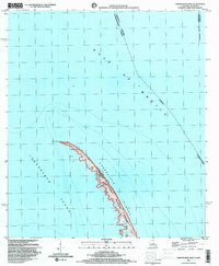
1998 Map of Chandeleur Light
USGS Topo · Published 2000About this map
Breton National Wildlife Refuge anchors this specialized coastal survey, capturing the fragile barrier islands of St. Bernard Parish at the close of the twentieth century. The map centers on the northern arc of the Chandeleur Islands, a landscape defined by shifting sands and open water. Significant navigation and maritime markers are preserved here, most notably the Chandeleur Light situated near Hewes Point.
Find a feature on this map
12 named features on this map. Tap any name to fly to it.
Don’t see what you’re looking for? This feature index may not catch every label — zoom into the map to look around manually.
Map Details
Editions of this 1998 Chandeleur Light Map
This is the sole edition of this map. No revisions or reprints were ever made.
Other maps of this area

1950 · Dog Keys Pass
USGS Topo · 1:24,000

1950 · Ship Island
USGS Topo · 1:24,000

1951 · North Islands
USGS Topo · 1:24,000

1951 · Chandeleur Light
USGS Topo · 1:24,000

1953 · Mobile
USGS Topo · 1:250,000

1957 · Mobile
USGS Topo · 1:250,000

1957 · Breton Sound
USGS Topo · 1:250,000

1960 · Mobile
USGS Topo · 1:250,000

1961 · Breton Sound
USGS Topo · 1:250,000

1963 · Mobile
USGS Topo · 1:250,000