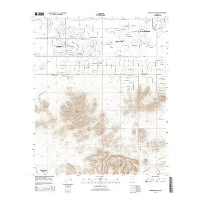
2014 Map of Chandler Heights
USGS Topo · Published 2014About this map
Queen Creek and the southeastern reaches of Gilbert define the northern half of this landscape, where the suburban grid of the Phoenix valley meets the rising topography of the Gila River Indian Reservation. The transition is sharp, marked by the Maricopa Co and Pinal Co boundary line. In the southern half, the elevation climbs abruptly into the Santan Mountains and the Malpais Hills, featuring prominent landmarks like Rock Peak and the pass known as The Gap. This 2014 survey captures the late-stage development of planned communities such as Sanokai Village and the namesake Chandler Heights. Water management is central to the area's history, evidenced by the Queen Cr Canal and the natural drainage of Queen Creek itself, which skirts the eastern edge of the township before it meets the rugged foothills near Goldmine Mtn.
Find a feature on this map
87 named features on this map. Tap any name to fly to it.
Don’t see what you’re looking for? This feature index may not catch every label — zoom into the map to look around manually.
Map Details
Editions of this 2014 Chandler Heights Map
This is the sole edition of this map. No revisions or reprints were ever made.
Other maps of this area

1904 · Desert Well
USGS Topo · 1:62,500

1906 · Desert Well
USGS Topo · 1:62,500

1907 · Sacaton
USGS Topo · 1:62,500

1913 · Mesa
USGS Topo · 1:62,500

1914 · Gila Butte
USGS Topo · 1:62,500

1915 · Mesa
USGS Topo · 1:62,500

1917 · Gila Butte
USGS Topo · 1:62,500

1952 · Gila Butte SE
USGS Topo · 1:24,000

1952 · Chandler
USGS Topo · 1:24,000

1952 · Gila Butte
USGS Topo · 1:24,000