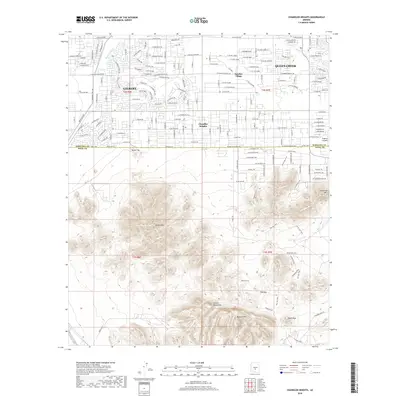
2018 Map of Chandler Heights
USGS Topo · Published 2018About this map
The transition from valley agriculture to suburban development is evident here, as the expanding footprints of Gilbert and Queen Creek meet the northern edges of the Gila River Indian Reservation. The northern half of the landscape is dominated by a dense grid of residential streets and arterial roads like E Ocotillo Rd, while the southern half remains characterized by the steep, undeveloped slopes of the Santan Mountains and the Malpais Hills. Water management is central to the area's history, marked by the Queen Cr Canal and Santan Canal.
Find a feature on this map
96 named features on this map. Tap any name to fly to it.
Don’t see what you’re looking for? This feature index may not catch every label — zoom into the map to look around manually.
Map Details
Editions of this 2018 Chandler Heights Map
This is the sole edition of this map. No revisions or reprints were ever made.
Other maps of this area

1904 · Desert Well
USGS Topo · 1:62,500

1906 · Desert Well
USGS Topo · 1:62,500

1907 · Sacaton
USGS Topo · 1:62,500

1913 · Mesa
USGS Topo · 1:62,500

1914 · Gila Butte
USGS Topo · 1:62,500

1915 · Mesa
USGS Topo · 1:62,500

1917 · Gila Butte
USGS Topo · 1:62,500

1952 · Gila Butte SE
USGS Topo · 1:24,000

1952 · Chandler
USGS Topo · 1:24,000

1952 · Gila Butte
USGS Topo · 1:24,000