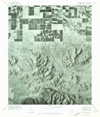
1971 Map of Chandler Heights
USGS Topo · Published 1972About this map
Chandler Heights appears as a structured grid of agricultural plots and citrus groves in this early 1970s orthophotoquad, showcasing the transition of the Arizona desert into a productive farming region. The irrigation patterns and rectangular fields of the settlement contrast sharply with the natural drainage of Queen Creek and the intricate, branching arroyos that spill out from the southern highlands. These peaks, identified as the Goldmine Mountains, dominate the lower half of the map with their complex, weather-worn slopes. The proximity of the Roosevelt road corridor highlights the infrastructure necessary to support this desert outpost. This photographic survey provides a rare look at the precise layout of local orchards and land use before subsequent decades of suburban expansion reached the southern edges of Maricopa and Pinal counties.
Find a feature on this map
4 named features on this map. Tap any name to fly to it.
Don’t see what you’re looking for? This feature index may not catch every label — zoom into the map to look around manually.
Map Details
Editions of this 1971 Chandler Heights Map
This is the sole edition of this map. No revisions or reprints were ever made.
Other maps of this area

1904 · Desert Well
USGS Topo · 1:62,500

1906 · Desert Well
USGS Topo · 1:62,500

1907 · Sacaton
USGS Topo · 1:62,500

1913 · Mesa
USGS Topo · 1:62,500

1914 · Gila Butte
USGS Topo · 1:62,500

1915 · Mesa
USGS Topo · 1:62,500

1917 · Gila Butte
USGS Topo · 1:62,500

1952 · Gila Butte SE
USGS Topo · 1:24,000

1952 · Chandler
USGS Topo · 1:24,000

1952 · Gila Butte
USGS Topo · 1:24,000