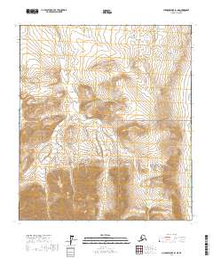
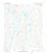
2017 Map of Chandler Lake B-1 NE
USGS Topo · Published 2017About this map
Gates Of The Arctic National Preserve spans the southern half of this Brooks Range territory, marking a high-latitude wilderness defined by stark topography and glacial drainages. The landscape is carved by the Itkillik River, which flows along the eastern boundary, and the broad Oolah Valley that cuts through the southeastern corner. These corridors provide natural passage through steep terrain, historically significant for both wildlife migration and traditional travel. High-elevation drainage systems like May Cr and Cobblestone Cr illustrate the complex watershed of the North Slope, where seasonal meltwater creates a intricate network of braided streams. This 2017 survey by the U.S. Geological Survey captures the untouched character of the central Arctic, where surveying townships like t11s r8e and t12s r9e overlay a land primarily governed by natural contours rather than human settlement.
Find a feature on this map
9 named features on this map. Tap any name to fly to it.
Don’t see what you’re looking for? This feature index may not catch every label — zoom into the map to look around manually.
Map Details
Editions of this 2017 Chandler Lake B-1 NE Map
This is the sole edition of this map. No revisions or reprints were ever made.
Other maps of this area

1951 · Chandler Lake
USGS Topo · 1:250,000

1951 · Brooks
USGS Topo · 1:250,000

1956 · Philip Smith Mountains
USGS Topo · 1:250,000

1956 · Chandler Lake
USGS Topo · 1:250,000

1964 · Philip Smith Mountains
USGS Topo · 1:250,000

1964 · Chandler Lake
USGS Topo · 1:250,000
1971 · Chandler Lake C-1
USGS Topo · 1:63,360
1971 · Philip Smith Mountains B-5
USGS Topo · 1:63,360
1971 · Chandler Lake B-1
USGS Topo · 1:63,360
1971 · Philip Smith Mountains C-5
USGS Topo · 1:63,360