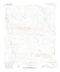
1971 Map of Chandler Lake D-2
USGS Topo · Published 1973About this map
The Anaktuvuk River and Nanushuk River define this remote North Slope landscape, flowing through a region dominated by dramatic high-altitude features. Rising between the river systems, Rooftop Ridge and the nearby Racetrack Basin illustrate the complex topography of the central Brooks Range foothills. To the south, Kayak Mountain stands as a prominent landmark above the waters of Sitchiak Lake. This 1971 survey captures the area at a time when accessibility was limited to specialized transit, as evidenced by the mapped Winter Road and Winter Trail. These seasonal routes represent the primary human infrastructure in a landscape otherwise shaped by natural drainages like Willow Creek and the steep elevation changes at Twin Bluffs. The map provides a detailed record of these ephemeral transport corridors before modern development altered arctic logistics.
Find a feature on this map
11 named features on this map. Tap any name to fly to it.
Don’t see what you’re looking for? This feature index may not catch every label — zoom into the map to look around manually.
Map Details
Editions of this 1971 Chandler Lake D-2 Map
This is the sole edition of this map. No revisions or reprints were ever made.
Other maps of this area

1951 · Chandler Lake
USGS Topo · 1:250,000

1952 · Umiat
USGS Topo · 1:250,000

1955 · Umiat A-3
USGS Topo · 1:63,360

1956 · Chandler Lake
USGS Topo · 1:250,000

1956 · Umiat
USGS Topo · 1:250,000

1964 · Chandler Lake
USGS Topo · 1:250,000

1964 · Umiat
USGS Topo · 1:250,000
1971 · Chandler Lake D-1
USGS Topo · 1:63,360
1971 · Chandler Lake C-2
USGS Topo · 1:63,360

1971 · Umiat A-2
USGS Topo · 1:63,360