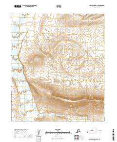
2017 Map of Chandler Lake D-2 NW
USGS Topo · Published 2017About this map
The Anaktuvuk River flows through this North Slope landscape, carving a wide valley floor as it moves north. This topographic study reveals the dramatic transition between the braided river plain and the high, rising terrain of the Brooks Range foothills. To the south, the elevation climbs steeply toward the crest of Rooftop Ridge, a prominent landform that dominates the lower half of the quadrangle. Tucked between these high points is the Racetrack Basin, a distinctive natural depression that illustrates the complex drainage patterns of the region. The map is organized by the township and range lines of t5s r4e, t5s r5e, t6s r4e, and t6s r5e, providing a precise grid for modern environmental study or land management in this arctic wilderness.
Find a feature on this map
7 named features on this map. Tap any name to fly to it.
Don’t see what you’re looking for? This feature index may not catch every label — zoom into the map to look around manually.
Map Details
Editions of this 2017 Chandler Lake D-2 NW Map
This is the sole edition of this map. No revisions or reprints were ever made.
Other maps of this area

1951 · Chandler Lake
USGS Topo · 1:250,000

1952 · Umiat
USGS Topo · 1:250,000

1955 · Umiat A-3
USGS Topo · 1:63,360

1956 · Chandler Lake
USGS Topo · 1:250,000

1956 · Umiat
USGS Topo · 1:250,000

1964 · Chandler Lake
USGS Topo · 1:250,000

1964 · Umiat
USGS Topo · 1:250,000

1971 · Umiat A-2
USGS Topo · 1:63,360
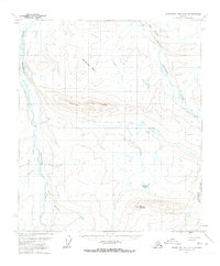
1971 · Chandler Lake D-2
USGS Topo · 1:63,360
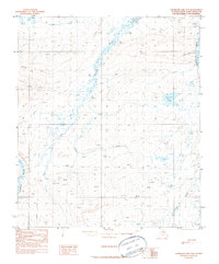
1987 · Chandler Lake D-3
USGS Topo · 1:63,360