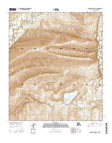
2016 Map of Chandler Lake D-3 NE
USGS Topo · Published 2016About this map
Ahaliorak Lake sits at the heart of this high-latitude terrain, where the hydrography of the North Slope is defined by the northward flow of the Anaktuvuk River and the meandering path of the Tuluga River. This 2016 survey, produced with data from the Alaska Dept. of Transportation and the BLM, captures a landscape of intense topographic relief where drainage patterns dictate the movement of water across the North Slope Borough. The lack of named settlements or roads reflects the isolation of the Arctic wilderness, emphasizing the natural corridors of the river valleys and the seasonal character of the wetlands documented by the FWS. The map serves as a primary record of the physical geography within the t5s r3e and t6s r4e townships, focusing on the unpopulated river basins of the far north.
Find a feature on this map
7 named features on this map. Tap any name to fly to it.
Don’t see what you’re looking for? This feature index may not catch every label — zoom into the map to look around manually.
Map Details
Editions of this 2016 Chandler Lake D-3 NE Map
This is the sole edition of this map. No revisions or reprints were ever made.
Other maps of this area

1951 · Chandler Lake
USGS Topo · 1:250,000

1952 · Umiat
USGS Topo · 1:250,000

1955 · Umiat A-3
USGS Topo · 1:63,360

1956 · Chandler Lake
USGS Topo · 1:250,000

1956 · Umiat
USGS Topo · 1:250,000

1964 · Chandler Lake
USGS Topo · 1:250,000

1964 · Umiat
USGS Topo · 1:250,000

1971 · Umiat A-2
USGS Topo · 1:63,360
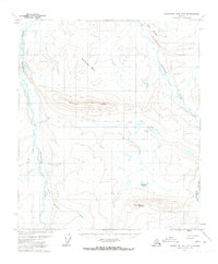
1971 · Chandler Lake D-2
USGS Topo · 1:63,360
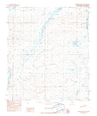
1987 · Chandler Lake D-3
USGS Topo · 1:63,360