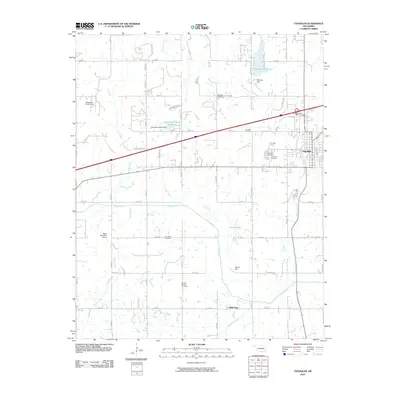
2010 Map of Chandler
USGS Topo · Published 2010About this map
The town of Chandler serves as a focal point for this survey, situated at the eastern edge where Interstate 44 and the Chandler Interchange meet the local grid. The landscape to the west is defined by a series of north-south drainage patterns, including Bellcow Creek, Rat Creek, and Pecan Creek, all of which eventually feed into the Deep Fork. This area contains a significant concentration of burial sites important for genealogical research, such as Oak Park Cemetery, Clearview Cemetery, and the McCorkle Cemetery near Soward Lake.
Find a feature on this map
48 named features on this map. Tap any name to fly to it.
Don’t see what you’re looking for? This feature index may not catch every label — zoom into the map to look around manually.
Map Details
Editions of this 2010 Chandler Map
This is the sole edition of this map. No revisions or reprints were ever made.
Other maps of this area

1905 · Chandler
USGS Topo · 1:62,500

1907 · Chandler
USGS Topo · 1:62,500

1908 · Agra
USGS Topo · 1:62,500

1909 · Luther
USGS Topo · 1:62,500

1909 · Perkins
USGS Topo · 1:62,500

1954 · Oklahoma City
USGS Topo · 1:250,000

1957 · Oklahoma City
USGS Topo · 1:250,000

1963 · Oklahoma City
USGS Topo · 1:250,000
1966 · Luther SE
USGS Topo · 1:24,000
1966 · Wellston
USGS Topo · 1:24,000