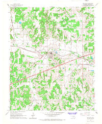
1966 Map of Wellston
USGS Topo · Published 1967About this map
The Wellston area of central Oklahoma is defined by the convergence of major mid-century transportation routes and the meandering path of the Deep Fork. This mid-1960s landscape shows the transition from earlier rail-dependent commerce to the high-speed transit of the Turner Toll Road, featuring a Tollgate just southwest of the main settlement. The St Louis - San Francisco Railroad continues to parallel the river, connecting smaller communities like Fallis, Gardner, and Warwick. Local industry and rural infrastructure are prominently marked, from numerous Oil Wells and Gravel Pits to the Fish hatchery and the Flying G Landing Field near the eastern boundary. Genealogists and local historians can locate community pillars such as the Church of the Living God and the Wellston Cem, alongside township divisions like Tohee, Otoe, and McKinley.
Find a feature on this map
30 named features on this map. Tap any name to fly to it.
Don’t see what you’re looking for? This feature index may not catch every label — zoom into the map to look around manually.
Map Details
Editions of this 1966 Wellston Map
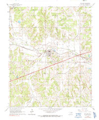
2 editions found
Other maps of this area

1905 · Chandler
USGS Topo · 1:62,500

1907 · Chandler
USGS Topo · 1:62,500

1908 · Agra
USGS Topo · 1:62,500

1909 · Luther
USGS Topo · 1:62,500

1909 · Perkins
USGS Topo · 1:62,500

1954 · Oklahoma City
USGS Topo · 1:250,000

1956 · Horseshoe Lake
USGS Topo · 1:24,000

1957 · Oklahoma City
USGS Topo · 1:250,000

1963 · Oklahoma City
USGS Topo · 1:250,000
1966 · Luther SE
USGS Topo · 1:24,000