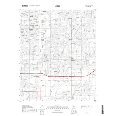
2018 Map of Chandler
USGS Topo · Published 2018About this map
The suburban expansion of the East Valley is documented here during a period of intense residential development in Maricopa County. Heavy urbanization centers around the southern portions of Mesa and the growing municipality of Gilbert, where a dense grid of subdivisions like Dobson Ranch, Marlborough Mesa, and Vista Alegre has replaced former agricultural fields. Despite this growth, the foundational water infrastructure of the Salt River Project remains visible, with the Western Canal, Consolidated Canal, and Eastern Canal cutting through the residential landscape. The Union Pacific RR corridor provides a central industrial axis, passing near established locales like Falfa and Sonora Town. Significant regional landmarks such as the Chandler Municipal Airport and the Chandler - Gilbert Community College Pecos Campus anchor the southern edge of this study, illustrating the transition from rural desert to a major metropolitan hub.
Find a feature on this map
51 named features on this map. Tap any name to fly to it.
Don’t see what you’re looking for? This feature index may not catch every label — zoom into the map to look around manually.
Map Details
Editions of this 2018 Chandler Map
This is the sole edition of this map. No revisions or reprints were ever made.
Other maps of this area

1904 · Desert Well
USGS Topo · 1:62,500

1906 · Desert Well
USGS Topo · 1:62,500

1907 · Sacaton
USGS Topo · 1:62,500

1913 · Mesa
USGS Topo · 1:62,500

1914 · Gila Butte
USGS Topo · 1:62,500

1915 · Mesa
USGS Topo · 1:62,500

1917 · Gila Butte
USGS Topo · 1:62,500

1952 · Tempe
USGS Topo · 1:24,000

1952 · Chandler
USGS Topo · 1:24,000

1952 · Gila Butte NW
USGS Topo · 1:24,000