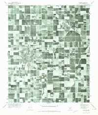
1971 Map of Chandler
USGS Topo · Published 1972About this map
Chandler and Gilbert are presented in this orthophotomosaic just as the Salt River Valley was undergoing a massive shift from an agrarian patchwork into a suburban landscape. The image, captured from 1971 aerial photography, reveals the rigid geometric precision of the irrigation network that fueled the region's growth. The Consolidated East Branch Canal and the Eastern Canal are clearly visible, slicing through the desert to sustain hundreds of individual agricultural plots. This specific survey provides a rare visual record of the area before the intense residential infill of the late 20th century, showing how the early footprints of these desert communities were still defined by the proximity of water and the grid of established section lines.
Find a feature on this map
4 named features on this map. Tap any name to fly to it.
Don’t see what you’re looking for? This feature index may not catch every label — zoom into the map to look around manually.
Map Details
Editions of this 1971 Chandler Map
This is the sole edition of this map. No revisions or reprints were ever made.
Other maps of this area

1904 · Desert Well
USGS Topo · 1:62,500

1906 · Desert Well
USGS Topo · 1:62,500

1907 · Sacaton
USGS Topo · 1:62,500

1913 · Mesa
USGS Topo · 1:62,500

1914 · Gila Butte
USGS Topo · 1:62,500

1915 · Mesa
USGS Topo · 1:62,500

1917 · Gila Butte
USGS Topo · 1:62,500

1952 · Tempe
USGS Topo · 1:24,000

1952 · Chandler
USGS Topo · 1:24,000

1952 · Gila Butte NW
USGS Topo · 1:24,000