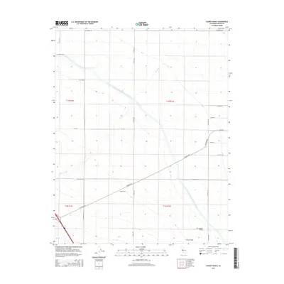
2015 Map of Chaney Ranch
USGS Topo · Published 2015About this map
San Joaquin Valley agriculture and massive water infrastructure define this 2015 layout of western Fresno County. The map is bisected by the Governor Edmund G Brown California Aqueduct, a colossal engineering feat essential to the region's productivity. Near the intersection of W Panoche Rd and S Fairfax Ave, the Chaney Ranch settlement serves as a localized hub within a vast grid of section lines and irrigation-dependent fields. The natural drainage of Panoche Creek winds through the landscape, offering a sharp contrast to the rigid geometry of the surrounding road network. Small named locales such as Annadale and Annedale appear along the eastern edge, marking the dispersed nature of habitation in this intensive farming belt. Researchers can trace the development of rural infrastructure through the dense network of local routes like W American Ave and N Millux Rd.
Find a feature on this map
27 named features on this map. Tap any name to fly to it.
Don’t see what you’re looking for? This feature index may not catch every label — zoom into the map to look around manually.
Map Details
Editions of this 2015 Chaney Ranch Map
This is the sole edition of this map. No revisions or reprints were ever made.
Other maps of this area

1913 · Panoche
USGS Topo · 1:125,000

1921 · Tierra Loma School
USGS Topo · 1:31,680

1922 · Tufts Ranch
USGS Topo · 1:31,680

1922 · Chaney Ranch
USGS Topo · 1:31,680

1923 · Levis
USGS Topo · 1:31,680

1923 · Wisdom Well
USGS Topo · 1:31,680

1923 · Firebaugh
USGS Topo · 1:31,680

1923 · Tierra Loma School
USGS Topo · 1:31,680

1923 · Little Panoche
USGS Topo · 1:31,680

1923 · Monocline Ridge
USGS Topo · 1:31,680