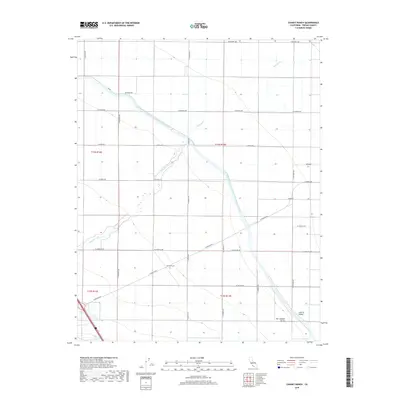
2018 Map of Chaney Ranch
USGS Topo · Published 2018About this map
Chaney Ranch and the small settlement of Annadale anchor this agricultural landscape in the western San Joaquin Valley, where the industrial scale of modern irrigation is on full display. The massive Governor Edmund G Brown California Aqueduct cuts diagonally across the terrain, serving as a primary artery for water transport through the Central Valley. This complex engineering works alongside natural drainage features like Panoche Creek, which meanders across the grid of section lines and county roads. The map reveals a strictly organized rural network, with roads such as W Belmont Ave and S Fairfax Ave defining the boundaries of large-scale farming operations. This environment demonstrates the total transformation of the arid valley floor into a highly managed hydraulic and agricultural system.
Find a feature on this map
31 named features on this map. Tap any name to fly to it.
Don’t see what you’re looking for? This feature index may not catch every label — zoom into the map to look around manually.
Map Details
Editions of this 2018 Chaney Ranch Map
This is the sole edition of this map. No revisions or reprints were ever made.
Other maps of this area

1913 · Panoche
USGS Topo · 1:125,000

1921 · Tierra Loma School
USGS Topo · 1:31,680

1922 · Tufts Ranch
USGS Topo · 1:31,680

1922 · Chaney Ranch
USGS Topo · 1:31,680

1923 · Levis
USGS Topo · 1:31,680

1923 · Wisdom Well
USGS Topo · 1:31,680

1923 · Firebaugh
USGS Topo · 1:31,680

1923 · Tierra Loma School
USGS Topo · 1:31,680

1923 · Little Panoche
USGS Topo · 1:31,680

1923 · Monocline Ridge
USGS Topo · 1:31,680