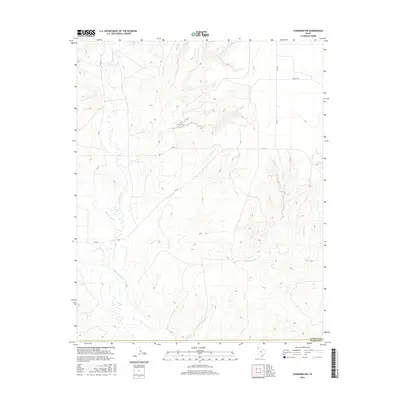
2016 Map of Channing NW
USGS Topo · Published 2016About this map
Rita Blanca Cr and Punta de Agua Cr define the western hydrology of this High Plains landscape, where the flat Texas Panhandle topography begins to break into the drainage systems of the Canadian River valley. The 2016 survey illustrates a sparse ranching and agricultural environment where the vast section-line grid is interrupted by the meandering course of Los Redos Cr in the southeast. Infrastructure is limited to a few arterial routes such as FM 767 and FM 2357, alongside local tracks like Nichols Rd. This map captures the modern layout of the Hartley and Oldham county line, reflecting the enduring rural character of the region where land use remains centered on large-scale grazing and dryland farming.
Find a feature on this map
8 named features on this map. Tap any name to fly to it.
Don’t see what you’re looking for? This feature index may not catch every label — zoom into the map to look around manually.
Map Details
Editions of this 2016 Channing NW Map
This is the sole edition of this map. No revisions or reprints were ever made.
Other maps of this area
1954 · Tucumcari
USGS Topo · 1:250,000
1958 · Tucumcari
USGS Topo · 1:250,000
1963 · Hartley SE
USGS Topo · 1:24,000
1971 · Proctor Ranch
USGS Topo · 1:24,000
1971 · Channing NW
USGS Topo · 1:24,000
1971 · Many Post Camp
USGS Topo · 1:24,000
1971 · Boys Ranch West
USGS Topo · 1:24,000
1971 · Torrey House
USGS Topo · 1:24,000
1971 · Channing
USGS Topo · 1:24,000
1972 · Hartley SW
USGS Topo · 1:24,000