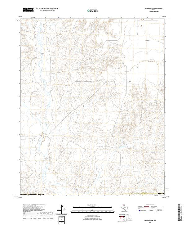
2022 Map of Channing NW
USGS Topo · Published 2022About this map
Rita Blanca Cr and Punta de Agua Cr define the drainage patterns of this corner of the Texas Panhandle, carving through the high plains north of the Canadian River valley. The landscape is characterized by these intermittent stream beds and the rugged breaks of the Llano Estacado, where cattle ranching has long been the primary economic driver. A sparse network of ranch-to-market roads, including Fm 767 and Fm 2357, provides access to the remote backcountry of Hartley and Oldham counties. The map highlights the transition between the flat upland plateaus and the dissected canyonlands surrounding Los Redos Cr, illustrating the isolation and specialized land use common in this semi-arid region during the early 21st century.
Find a feature on this map
8 named features on this map. Tap any name to fly to it.
Don’t see what you’re looking for? This feature index may not catch every label — zoom into the map to look around manually.
Map Details
Editions of this 2022 Channing NW Map
This is the sole edition of this map. No revisions or reprints were ever made.
Other maps of this area

1954 · Tucumcari
USGS Topo · 1:250,000

1958 · Tucumcari
USGS Topo · 1:250,000

1963 · Hartley SE
USGS Topo · 1:24,000

1971 · Proctor Ranch
USGS Topo · 1:24,000

1971 · Channing NW
USGS Topo · 1:24,000

1971 · Many Post Camp
USGS Topo · 1:24,000

1971 · Boys Ranch West
USGS Topo · 1:24,000
1971 · Torrey House
USGS Topo · 1:24,000
1971 · Channing
USGS Topo · 1:24,000

1972 · Hartley SW
USGS Topo · 1:24,000