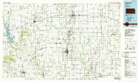
1985 Map of Chanute
USGS Topo · Published 1986About this map
The Neosho River and Verdigris River define the agricultural and industrial landscape of Southeast Kansas in this mid-1980s compilation. Regional centers like Chanute, Iola, and Humboldt anchor a network of smaller rail towns and farming communities, including Yates Center, Fredonia, and Toronto. The map documents a complex transportation infrastructure, featuring the routes of the Atchison Topeka and Santa Fe, Missouri Pacific, and Missouri-Kansas-Texas railroads as they connect grain elevators and local commerce.
Find a feature on this map
97 named features on this map. Tap any name to fly to it.
Don’t see what you’re looking for? This feature index may not catch every label — zoom into the map to look around manually.
Map Details
Editions of this 1985 Chanute Map
This is the sole edition of this map. No revisions or reprints were ever made.
Other maps of this area

1884 · Fort Scott
USGS Topo · 1:125,000

1885 · Burlington
USGS Topo · 1:125,000

1885 · Eureka
USGS Topo · 1:125,000

1885 · Garnett
USGS Topo · 1:125,000

1885 · Sedan
USGS Topo · 1:125,000

1886 · Fredonia
USGS Topo · 1:125,000

1886 · Joplin
USGS Topo · 1:125,000

1886 · Iola
USGS Topo · 1:125,000

1886 · Independence
USGS Topo · 1:125,000

1886 · Fort Scott
USGS Topo · 1:125,000