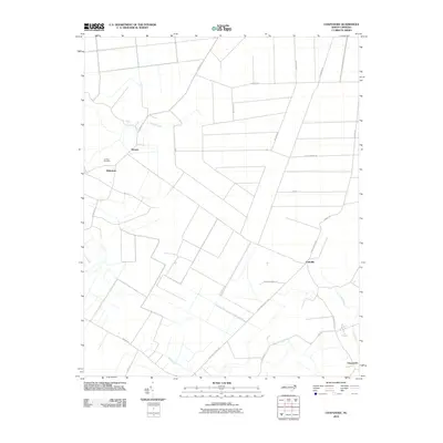
2010 Map of Chapanoke
USGS Topo · Published 2010About this map
Nicanor and the surrounding coastal plain of Perquimans County are defined by a network of drainage ways and rural road corridors. The landscape is structured by several key watercourses, including Indian Creek in the north and the Little River and Mill Creek to the south. Small settlements like Whiteston and Parkville are connected by distinctive local routes such as 4 Mile Desert Rd and Four Mile Desert Rd, reflecting the historical layout of this low-lying region. Near the western edge, the Up River Cemetery serves as a significant genealogical landmark, while the community of Chapanoke anchors the southeastern corner. This survey documents the intersection of modern road infrastructure, like Old Dominion Rd and Turnpike Rd, with the persistent natural hydrology that has shaped the agricultural and residential patterns of this part of North Carolina for generations.
Find a feature on this map
25 named features on this map. Tap any name to fly to it.
Don’t see what you’re looking for? This feature index may not catch every label — zoom into the map to look around manually.
Map Details
Editions of this 2010 Chapanoke Map
This is the sole edition of this map. No revisions or reprints were ever made.
Other maps of this area

1904 · Edenton
USGS Topo · 1:62,500

1906 · Hertford
USGS Topo · 1:62,500

1906 · Beckford
USGS Topo · 1:48,000

1907 · Beckford
USGS Topo · 1:62,500

1940 · Hertford
USGS Topo · 1:62,500

1940 · Beckford
USGS Topo · 1:62,500

1940 · South Mills
USGS Topo · 1:62,500

1942 · Edenton
USGS Topo · 1:62,500

1943 · Edenton
USGS Topo · 1:62,500

1952 · South Mills
USGS Topo · 1:62,500