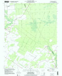
1997 Map of Chapanoke
USGS Topo · Published 2000About this map
The Great Dismal Swamp dominates the eastern landscape of this coastal plain region, where the borders of Gates, Pasquotank, and Perquimans counties converge. In the late twentieth century, the area remained defined by its waterways and agricultural tracts, with the Perquimans River and Little River providing the primary natural drainage. Small rural communities like Chapanoke and Parkville are connected by a network of local roads and remnants of former transport corridors, most notably the Old Railroad Grade which cuts through the timber and swamp north of Nicanor. Genealogists and local historians can locate several points of interest, including Up River Ch, Oak Grove Ch, and numerous unnamed Cem locations scattered throughout the settlements of Whiteston and the surrounding farmland.
Find a feature on this map
14 named features on this map. Tap any name to fly to it.
Don’t see what you’re looking for? This feature index may not catch every label — zoom into the map to look around manually.
Map Details
Editions of this 1997 Chapanoke Map
This is the sole edition of this map. No revisions or reprints were ever made.
Other maps of this area

1904 · Edenton
USGS Topo · 1:62,500

1906 · Hertford
USGS Topo · 1:62,500

1906 · Beckford
USGS Topo · 1:48,000

1907 · Beckford
USGS Topo · 1:62,500

1940 · Hertford
USGS Topo · 1:62,500

1940 · Beckford
USGS Topo · 1:62,500

1940 · South Mills
USGS Topo · 1:62,500

1942 · Edenton
USGS Topo · 1:62,500

1943 · Edenton
USGS Topo · 1:62,500

1952 · South Mills
USGS Topo · 1:62,500