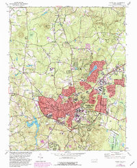
1978 Map of Chapel Hill
USGS Topo · Published 1982About this map
The University of North Carolina and its surrounding academic landscape dominate the southeastern portion of this survey, featuring Kenan Stadium and the specialized medical complex near the Hospital. Growth patterns in the late 1970s and early 1980s are evident in the sprawling residential developments of Carrboro and Chapel Hill, while the northern reaches maintain a more rural character defined by prominent heights like Blackwood Mtn and Piney Mtn.
Find a feature on this map
86 named features on this map. Tap any name to fly to it.
Don’t see what you’re looking for? This feature index may not catch every label — zoom into the map to look around manually.
Map Details
Editions of this 1978 Chapel Hill Map
3 editions found
Other maps of this area

1943 · Durham South
USGS Topo · 1:62,500

1946 · Chapel Hill
USGS Topo · 1:24,000

1947 · Chapel Hill
USGS Topo · 1:31,680

1951 · Farrington
USGS Topo · 1:24,000

1951 · Durham South
USGS Topo · 1:62,500

1951 · Durham North
USGS Topo · 1:62,500

1953 · Raleigh
USGS Topo · 1:250,000

1953 · Greensboro
USGS Topo · 1:250,000

1954 · Greensboro
USGS Topo · 1:250,000

1954 · Raleigh
USGS Topo · 1:250,000