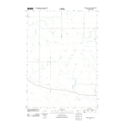
2012 Map of Chapelle Lake SE
USGS Topo · Published 2012About this map
S Chapelle Cr and Chaney Rush Cr meander through the rural landscape of Hyde County, following the natural drainage patterns of this high plains region. The map reveals a strictly regulated grid of section-line roads, typical of the Homestead Act's enduring legacy on the American West. Key transit corridors like Holabird Grade and 208th St provide the primary framework for local travel between sprawling agricultural plots. To the east, the headwaters of the W Fork Elm Cr emerge, cutting small basins into the terrain. This 2012 survey illustrates the modern layout of the Fort Thompson District, where the intersection of traditional section roads like 330th Ave and 212th St define the sparse residential and ranching footprint of central South Dakota.
Find a feature on this map
15 named features on this map. Tap any name to fly to it.
Don’t see what you’re looking for? This feature index may not catch every label — zoom into the map to look around manually.
Map Details
Editions of this 2012 Chapelle Lake SE Map
This is the sole edition of this map. No revisions or reprints were ever made.
Other maps of this area

1953 · Huron
USGS Topo · 1:250,000

1954 · Huron
USGS Topo · 1:250,000

1966 · Lower Brule NW
USGS Topo · 1:24,000

1966 · Stephan
USGS Topo · 1:24,000

1966 · Lower Brule NE
USGS Topo · 1:24,000

1973 · Chapelle Lake SE
USGS Topo · 1:24,000

1973 · Chapelle Lake SW
USGS Topo · 1:24,000

1973 · Chapelle Lake
USGS Topo · 1:24,000

1973 · Macs Corner
USGS Topo · 1:24,000
1973 · Macs Corner NW
USGS Topo · 1:24,000