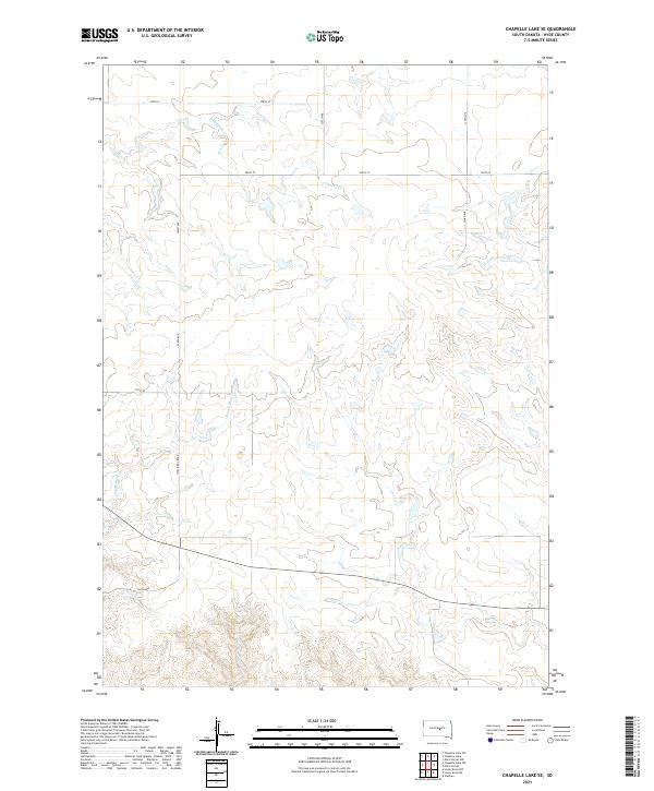
2021 Map of Chapelle Lake SE
USGS Topo · Published 2021About this map
Chaney Rush Cr and S Chapelle Cr define the drainage patterns of this rural Hyde County landscape, where the prairie is organized by a precise grid of sectional roads. The survey emphasizes the agricultural layout of the early 21st century, centered on transport corridors like Holabird Grade and 212th St. These routes follow the Public Land Survey System boundaries, specifically across Township 110 North, where the headwaters of W Fork Elm Cr begin to carve through the terrain. The lack of concentrated settlements highlights the region's character as a wide-open ranching or farming territory, where local history is tied more to the land and the township lines than to town centers.
Find a feature on this map
17 named features on this map. Tap any name to fly to it.
Don’t see what you’re looking for? This feature index may not catch every label — zoom into the map to look around manually.
Map Details
Editions of this 2021 Chapelle Lake SE Map
This is the sole edition of this map. No revisions or reprints were ever made.
Other maps of this area

1953 · Huron
USGS Topo · 1:250,000

1954 · Huron
USGS Topo · 1:250,000

1966 · Lower Brule NW
USGS Topo · 1:24,000

1966 · Stephan
USGS Topo · 1:24,000

1966 · Lower Brule NE
USGS Topo · 1:24,000

1973 · Chapelle Lake SE
USGS Topo · 1:24,000

1973 · Chapelle Lake SW
USGS Topo · 1:24,000

1973 · Chapelle Lake
USGS Topo · 1:24,000

1973 · Macs Corner
USGS Topo · 1:24,000
1973 · Macs Corner NW
USGS Topo · 1:24,000