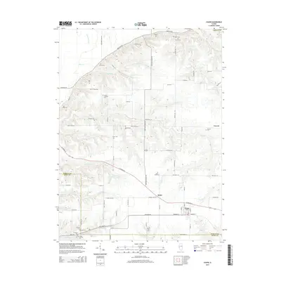
2015 Map of Chapin
USGS Topo · Published 2015About this map
The village of Chapin and the community of Bethel anchor this portion of Morgan County, where the agricultural landscape is divided by the modern alignment of US Highway 67. The terrain is defined by the winding paths of Coon Run, Wolf Run, and Spring Run, which cut through the drainage patterns of the Hefner Hills. This area is particularly rich for genealogical research, documenting a high density of small family and community burial grounds including Charles Schlickers Cem, Tholen Cem, and Hemminghaus Cem. These cemeteries, often tucked along rural routes like Spunky Ridge Rd or near the drainage of Willow Cr, reflect the deep-rooted settlement history of the Illinois prairie. The map further details the transition into Scott County to the south, marked by the confluence of Eagle Run and the presence of the Trinity Lutheran Cem near the township lines.
Find a feature on this map
80 named features on this map. Tap any name to fly to it.
Don’t see what you’re looking for? This feature index may not catch every label — zoom into the map to look around manually.
Map Details
Editions of this 2015 Chapin Map
This is the sole edition of this map. No revisions or reprints were ever made.
Other maps of this area

1924 · Winchester
USGS Topo · 1:48,000

1924 · Griggsville
USGS Topo · 1:62,500

1926 · Griggsville
USGS Topo · 1:62,500

1926 · Winchester
USGS Topo · 1:62,500

1928 · Meredosia
USGS Topo · 1:62,500

1929 · Arenzville
USGS Topo · 1:62,500

1931 · Meredosia
USGS Topo · 1:62,500

1932 · Arenzville
USGS Topo · 1:62,500

1948 · Quincy
USGS Topo · 1:250,000

1956 · Quincy
USGS Topo · 1:250,000