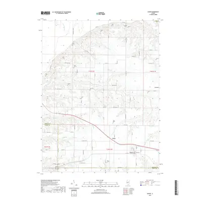
2018 Map of Chapin
USGS Topo · Published 2018About this map
Chapin and the surrounding farmland of Morgan County are defined by a dense network of family-named cemeteries and rural roads in this modern topographic study. The landscape is carved by a series of waterways, including Coon Run, Wolf Run, and the Pankey Pond Ditch, which drain the agricultural tracts north of the Morgan Co Scott Co line. Significant genealogical resources are scattered throughout the quadrangle, from the Trinity Lutheran Cem and Neelyville Cem in the south to the Burrus Cem and Houston Cem near the northern boundary. The settlements of Bethel and Concord remain prominent local hubs, connected by established routes like Co Rd 17 and Co Hwy 11. This 2018 survey provides an exact record of traditional family burial grounds and property boundaries, such as the Charles Schlickers Cem and Tippet William Cem, reflecting generations of residency in the Illinois prairie.
Find a feature on this map
83 named features on this map. Tap any name to fly to it.
Don’t see what you’re looking for? This feature index may not catch every label — zoom into the map to look around manually.
Map Details
Editions of this 2018 Chapin Map
This is the sole edition of this map. No revisions or reprints were ever made.
Other maps of this area

1924 · Winchester
USGS Topo · 1:48,000

1924 · Griggsville
USGS Topo · 1:62,500

1926 · Griggsville
USGS Topo · 1:62,500

1926 · Winchester
USGS Topo · 1:62,500

1928 · Meredosia
USGS Topo · 1:62,500

1929 · Arenzville
USGS Topo · 1:62,500

1931 · Meredosia
USGS Topo · 1:62,500

1932 · Arenzville
USGS Topo · 1:62,500

1948 · Quincy
USGS Topo · 1:250,000

1956 · Quincy
USGS Topo · 1:250,000