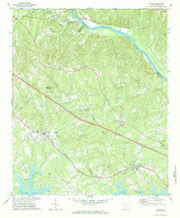
1971 Map of Chapin
USGS Topo · Published 1984About this map
Lake Murray borders the southern reaches of this landscape, its indented shoreline meeting the rising terrain where Chapin sits as a central hub. The area is defined by a dense network of country churches and family-named landmarks, reflecting a deep-seated community structure in the early 1970s. Key social and spiritual centers like St Johns Ch and Mt Horeb Ch are situated near the town center, while more rural outposts such as Piney Grove Ch and St Jacobs Ch dot the woods to the north and east.
Find a feature on this map
42 named features on this map. Tap any name to fly to it.
Don’t see what you’re looking for? This feature index may not catch every label — zoom into the map to look around manually.
Map Details
Editions of this 1971 Chapin Map
3 editions found
Other maps of this area

1904 · Columbia
USGS Topo · 1:125,000

1941 · Spartanburg
USGS Topo · 1:250,000

1946 · Irmo
USGS Topo · 1:24,000

1947 · Richtex
USGS Topo · 1:24,000

1948 · Irmo
USGS Topo · 1:24,000

1949 · Richtex
USGS Topo · 1:24,000

1953 · Spartanburg
USGS Topo · 1:250,000

1960 · Spartanburg
USGS Topo · 1:250,000

1963 · Spartanburg
USGS Topo · 1:250,000

1964 · Spartanburg
USGS Topo · 1:250,000