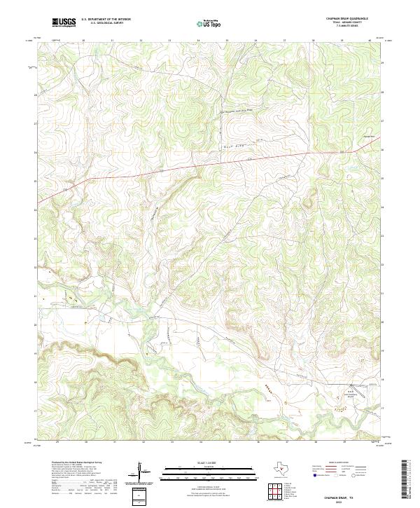
2022 Map of Chapman Draw
USGS Topo · Published 2022About this map
The San Saba River meanders through the southern portion of this Menard County landscape, defining the local drainage patterns and serving as a focal point for ranch access roads. The terrain is characterized by a series of significant draws and intermittent streams that carve into the Edwards Plateau, including the aptly named One Hundred Sixty Acre Draw, Mann Draw, and Chapman Draw. These natural features, along with Hyman Hill, dictate the winding paths of local routes like Vinegaroon Rd and Ranch Rd 2092.
Find a feature on this map
26 named features on this map. Tap any name to fly to it.
Don’t see what you’re looking for? This feature index may not catch every label — zoom into the map to look around manually.
Map Details
Editions of this 2022 Chapman Draw Map
This is the sole edition of this map. No revisions or reprints were ever made.
Other maps of this area

1892 · Eden
USGS Topo · 1:125,000

1896 · Eden
USGS Topo · 1:125,000

1954 · Brownwood
USGS Topo · 1:250,000

1954 · Llano
USGS Topo · 1:250,000

1955 · Llano
USGS Topo · 1:250,000

1956 · Llano
USGS Topo · 1:250,000

1970 · Callan
USGS Topo · 1:24,000
1970 · Needle Creek
USGS Topo · 1:24,000

1970 · East Elm Creek
USGS Topo · 1:24,000
1970 · Hext
USGS Topo · 1:24,000