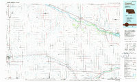
1985 Map of Chappell
USGS Topo · Published 1986About this map
The North Platte River and the South Platte River define the migratory and industrial corridors of the Nebraska panhandle in this 1985 survey. The historic Oregon Trail snakes along the northern valley, passing through land marked by the Bluewater Battlefield Overlook Site and the landmark Ash Hollow State Historical Park. This terrain is characterized by dramatic escarpments like Eagles Cliff and Sugar Loaf, which loom over the river bottoms and the growing waters of Lake McConaughy to the east.
Find a feature on this map
67 named features on this map. Tap any name to fly to it.
Don’t see what you’re looking for? This feature index may not catch every label — zoom into the map to look around manually.
Map Details
Editions of this 1985 Chappell Map
2 editions found
Other maps of this area

1896 · Browns Creek
USGS Topo · 1:125,000

1897 · Ogallala
USGS Topo · 1:125,000

1898 · Camp Clarke
USGS Topo · 1:125,000

1899 · Browns Creek
USGS Topo · 1:125,000

1899 · Sidney
USGS Topo · 1:125,000

1900 · Chappell
USGS Topo · 1:125,000

1900 · Ogallala
USGS Topo · 1:125,000

1949 · Rackett
USGS Topo · 1:62,500

1950 · Velma
USGS Topo · 1:62,500

1950 · Crescent Lake
USGS Topo · 1:62,500