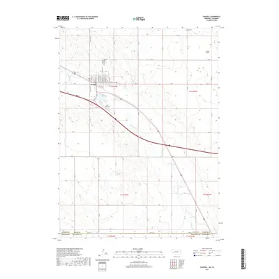
2017 Map of Chappell
USGS Topo · Published 2017About this map
Chappell serves as the primary center of activity in this part of Deuel County, situated where the grid of the town meets the winding course of Lodgepole Cr. The map illustrates a landscape defined by agricultural infrastructure and transport, with the town's layout bordered by Railroad St and the local aviation hub at Billy G Ray Field. This 2017 edition records the intersection of modern logistics and early settlement patterns, visible in the placement of the Chappell Cem and the Mennonite Cem further north. Water management is a central theme of the terrain, as seen in the path of the Highline Canal crossing the Nebraska-Colorado border and the natural drainage of O Neil Draw. The surrounding landscape is etched with a network of section-line roads, including Wheatland Dr and RD 14, which facilitate the region's ranching and farming economy.
Find a feature on this map
33 named features on this map. Tap any name to fly to it.
Don’t see what you’re looking for? This feature index may not catch every label — zoom into the map to look around manually.
Map Details
Editions of this 2017 Chappell Map
This is the sole edition of this map. No revisions or reprints were ever made.
Other maps of this area

1899 · Sidney
USGS Topo · 1:125,000

1900 · Chappell
USGS Topo · 1:125,000

1953 · Ovid
USGS Topo · 1:24,000

1953 · Julesburg
USGS Topo · 1:24,000

1953 · Sedgwick
USGS Topo · 1:24,000

1954 · Sterling
USGS Topo · 1:250,000

1954 · Scottsbluff
USGS Topo · 1:250,000

1958 · Scottsbluff
USGS Topo · 1:250,000

1958 · Sterling
USGS Topo · 1:250,000

1961 · Chappell
USGS Topo · 1:24,000