
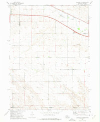
1971 Map of Chappell NW
USGS Topo · Published 1974About this map
The high plains of the Nebraska Panhandle are captured here in the early 1970s, specifically where the border of Garden and Deuel counties meets. The landscape is defined by its drainage patterns, most notably the winding course of Walrath Draw and the upper reaches of Ash Hollow. These features reflect the semi-arid geography of the region, where seasonal water flow has carved distinct depressions into the plateau. Human activity is sparse but specialized, marked by the long-distance infrastructure of a Pipeline cutting diagonally across the terrain and a localized Gravel Pit near the southern boundary. The topography shows the subtle, undulating character of the land just north of the Lodgepole Creek valley, providing a clear record of land use and natural drainage before modern agricultural or infrastructure changes.
Find a feature on this map
5 named features on this map. Tap any name to fly to it.
Don’t see what you’re looking for? This feature index may not catch every label — zoom into the map to look around manually.
Map Details
Editions of this 1971 Chappell NW Map
This is the sole edition of this map. No revisions or reprints were ever made.
Other maps of this area

1899 · Sidney
USGS Topo · 1:125,000

1900 · Chappell
USGS Topo · 1:125,000

1954 · Scottsbluff
USGS Topo · 1:250,000

1958 · Scottsbluff
USGS Topo · 1:250,000

1961 · Chappell
USGS Topo · 1:24,000

1961 · Chappell SE
USGS Topo · 1:24,000

1971 · Barn Butte
USGS Topo · 1:24,000

1971 · Chappell NE
USGS Topo · 1:24,000

1971 · Oshkosh SW
USGS Topo · 1:24,000
1972 · Lodgepole SE
USGS Topo · 1:24,000