
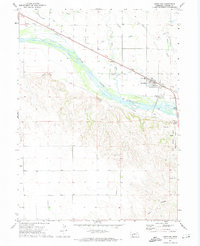
1971 Map of Chappell NE
USGS Topo · Published 1974About this map
Garden Co and Deuel Co meet in this Nebraska landscape, where the high plains terrain is defined by dramatic depressions and intermittent drainages. The north-south boundary line divides the sheet, which was field checked in the early 1970s following photogrammetric mapping. Local religious life is anchored at Berea Ch, while the industrial footprint of the region is visible through several Gravel Pit operations and more extensive Gravel Pits located further south. Physical geography is dominated by notable natural features like the rugged Ash Hollow in the northeast corner and the winding Walrath Draw in the south. Technical infrastructure is also present, marked by a major Pipeline that traverses the central and southern sections, crossing near isolated ranch Wells that provide critical water access in this semi-arid environment.
Find a feature on this map
8 named features on this map. Tap any name to fly to it.
Don’t see what you’re looking for? This feature index may not catch every label — zoom into the map to look around manually.
Map Details
Editions of this 1971 Chappell NE Map
This is the sole edition of this map. No revisions or reprints were ever made.
Other maps of this area

1900 · Chappell
USGS Topo · 1:125,000

1954 · Scottsbluff
USGS Topo · 1:250,000

1958 · Scottsbluff
USGS Topo · 1:250,000

1961 · Chappell
USGS Topo · 1:24,000

1961 · Barton
USGS Topo · 1:24,000

1961 · Chappell SE
USGS Topo · 1:24,000

1971 · Barn Butte
USGS Topo · 1:24,000

1971 · Oshkosh SW
USGS Topo · 1:24,000
1971 · Lewellen
USGS Topo · 1:24,000

1971 · Chappell NW
USGS Topo · 1:24,000