
1961 Map of Barton
USGS Topo · Published 1963About this map
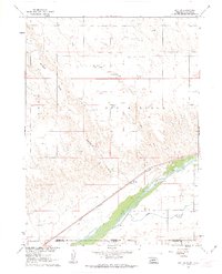
The South Platte River and its accompanying Union Pacific rail corridor define this high-plains landscape along the Nebraska-Colorado border. Centered on the settlement of Barton, the map illustrates a landscape transitioned into an organized network of water management and energy extraction during the early 1960s. Irrigation features like the State Line Ditch and Western Canal run parallel to the river, supporting the agricultural life of the valley. To the north, the terrain rises into the dissected plateaus of Big Springs, where the dry beds of Walrath Draw and Dry Creek mark the natural drainage. This era shows significant industrial development with numerous Gas Wells scattered across the uplands, while local education is still anchored by rural sites such as Plainview Sch and Longview Sch.
Find a feature on this map
14 named features on this map. Tap any name to fly to it.
Don’t see what you’re looking for? This feature index may not catch every label — zoom into the map to look around manually.
Map Details
Editions of this 1961 Barton Map
3 editions found
Other maps of this area

1900 · Chappell
USGS Topo · 1:125,000

1953 · Julesburg
USGS Topo · 1:24,000

1954 · Sterling
USGS Topo · 1:250,000

1954 · Scottsbluff
USGS Topo · 1:250,000

1958 · Scottsbluff
USGS Topo · 1:250,000

1958 · Sterling
USGS Topo · 1:250,000

1961 · Big Springs
USGS Topo · 1:24,000

1961 · Chappell SE
USGS Topo · 1:24,000
1962 · Venango NE
USGS Topo · 1:24,000
1962 · Venango NW
USGS Topo · 1:24,000