
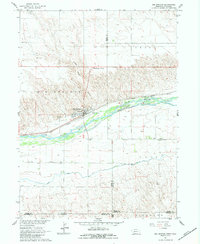
1961 Map of Big Springs
USGS Topo · Published 1963About this map
The South Platte River carves a broad valley through the high plains of the Nebraska-Colorado border, creating a vital corridor for transportation and agriculture in the early 1960s. The town of Big Springs serves as a central hub, situated along the Union Pacific railroad and near the confluence of local irrigation systems like the Western Canal. This survey illustrates the intricate balance between the braided river channels and the surrounding agricultural landscape, where numerous wells are noted throughout the bottomlands. Regional education and community life are anchored by the Cottonwood Corner Sch and School No 30, while the Big Springs Cem sits just west of the main settlement. The presence of the Western Canal suggests the importance of water management for sustaining the Highland terrain and valley floor farms during this era of post-war development.
Find a feature on this map
24 named features on this map. Tap any name to fly to it.
Don’t see what you’re looking for? This feature index may not catch every label — zoom into the map to look around manually.
Map Details
Editions of this 1961 Big Springs Map
2 editions found
Other maps of this area

1897 · Ogallala
USGS Topo · 1:125,000

1900 · Chappell
USGS Topo · 1:125,000

1900 · Ogallala
USGS Topo · 1:125,000

1954 · Sterling
USGS Topo · 1:250,000

1954 · Scottsbluff
USGS Topo · 1:250,000

1954 · McCook
USGS Topo · 1:250,000

1954 · North Platte
USGS Topo · 1:250,000

1956 · North Platte
USGS Topo · 1:250,000

1957 · North Platte
USGS Topo · 1:250,000

1957 · McCook
USGS Topo · 1:250,000