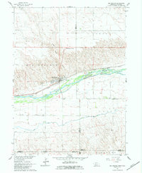
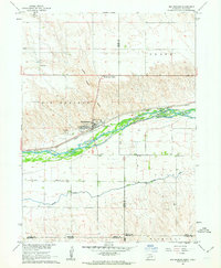
1961 Map of Big Springs
USGS Topo · Published 1983About this map
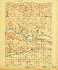
Big Springs sits as the primary hub of this high plains region, positioned at a critical geographic junction where the Union Pacific railroad parallels the braided channels of the South Platte River. The settlement pattern reflects the agricultural and transport-driven economy of the early 1960s, with development concentrated near Big Springs Junction and extending south toward the state line. Land use is sharply divided by topography; the river valley hosts the major infrastructure, including the Western Canal and various Wells, while the surrounding plateaus are marked by the sparse placement of rural institutions like School No 30 and Cottonwood Corner School. This survey captures the borderlands of Deuel County just as the modern highway network began to consolidate, showing the proximity of the Big Springs Cemetery and specialized local terrain features such as Trailer House Gulch.
Find a feature on this map
19 named features on this map. Tap any name to fly to it.
Don’t see what you’re looking for? This feature index may not catch every label — zoom into the map to look around manually.
Map Details
Editions of this 1961 Big Springs Map
2 editions found
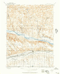
Other maps of this area
1897 · Ogallala
USGS Topo · 1:125,000
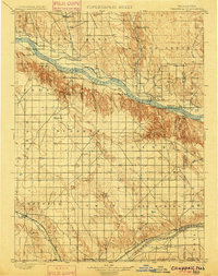
1900 · Chappell
USGS Topo · 1:125,000
1900 · Ogallala
USGS Topo · 1:125,000

1954 · Sterling
USGS Topo · 1:250,000

1954 · Scottsbluff
USGS Topo · 1:250,000

1954 · McCook
USGS Topo · 1:250,000

1954 · North Platte
USGS Topo · 1:250,000

1956 · North Platte
USGS Topo · 1:250,000

1957 · North Platte
USGS Topo · 1:250,000

1957 · McCook
USGS Topo · 1:250,000