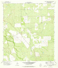
1974 Map of Charco Marrano Creek
USGS Topo · Published 1977About this map
The Nueces River winds through the southwestern corner of this La Salle County landscape, where the confluence with Las Raices Creek marks a distinct break in the brush country. The eponymous Charco Marrano Creek carves a path from the north, its drainage system defining much of the central terrain. While primarily rural and focused on ranching at the Black Ranch, the land shows significant industrial development following the discovery of petroleum and natural gas.
Find a feature on this map
9 named features on this map. Tap any name to fly to it.
Don’t see what you’re looking for? This feature index may not catch every label — zoom into the map to look around manually.
Map Details
Editions of this 1974 Charco Marrano Creek Map
This is the sole edition of this map. No revisions or reprints were ever made.
Other maps of this area

1929 · Cotulla
USGS Topo · 1:125,000

1940 · Cotulla
USGS Topo · 1:62,500

1942 · Fowlerton
USGS Topo · 1:62,500

1953 · Crystal City
USGS Topo · 1:250,000

1955 · Crystal City
USGS Topo · 1:250,000

1956 · Piedra Creek
USGS Topo · 1:62,500

1956 · Fowlerton
USGS Topo · 1:62,500

1957 · Caiman Creek
USGS Topo · 1:62,500

1961 · Crystal City
USGS Topo · 1:250,000

1968 · Crystal City
USGS Topo · 1:250,000