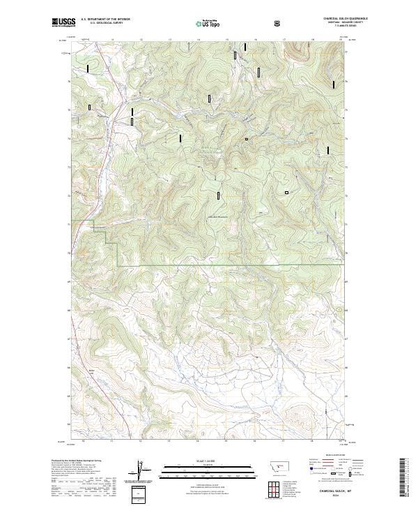
2024 Map of Charcoal Gulch
USGS Topo · Published 2024About this map
The Lewis & Clark National Forest encompasses this high-altitude landscape in Meagher County, defined by the sharp ridges of the Little Belt Mountains. The map reveals a complex network of drainages and seasonal water sources, including the headwaters of Newlan Creek and Reese Creek, which cut through numerous gulches like Miller Gulch and Chinaman Gulch. The elevation peaks at landmarks such as Smoky Mtn and Butler Hill, while smaller water features like Crater Lake and Charcoal Spring provide critical points of interest in an otherwise arid timberland.
Find a feature on this map
32 named features on this map. Tap any name to fly to it.
Don’t see what you’re looking for? This feature index may not catch every label — zoom into the map to look around manually.
Map Details
Editions of this 2024 Charcoal Gulch Map
This is the sole edition of this map. No revisions or reprints were ever made.
Other maps of this area

1886 · Little Belt Mts.
USGS Topo · 1:250,000

1894 · Little Belt Mts.
USGS Topo · 1:250,000

1897 · Little Belt Mts.
USGS Topo · 1:250,000

1898 · Little Belt Mts.
USGS Topo · 1:250,000

1902 · Little Belt Mts.
USGS Topo · 1:250,000

1948 · White Sulphur Springs
USGS Topo · 1:250,000

1958 · White Sulphur Springs
USGS Topo · 1:250,000

1961 · White Sulphur Springs
USGS Topo · 1:250,000
1961 · Kings Hill
USGS Topo · 1:24,000
1961 · Neihart
USGS Topo · 1:62,500