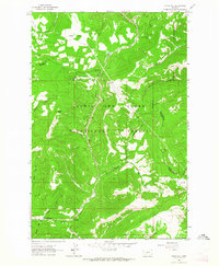
1961 Map of Kings Hill
USGS Topo · Published 1964About this map
Kings Hill Pass marks a high point in this 1961 survey, where U. S. 89 snakes through the high country of the Lewis and Clark National Forest. The map captures a landscape defined by sharp divides and a complex network of drainages, where the headwaters of Belt Creek and Sheep Creek diverge. The geography is characterized by prominent summits like Porphyry Peak and Mizpah Peak, which tower over numerous timbered basins. Local activity centers on high-altitude recreation and resource extraction, evidenced by the Kings Hill Campground and a Quarry located near the southern boundary. The intersection of county lines for Cascade, Judith Basin, and Meagher counties all converge here, illustrating the jurisdictional complexity of these mountain ranges during the early 1960s.
Find a feature on this map
34 named features on this map. Tap any name to fly to it.
Don’t see what you’re looking for? This feature index may not catch every label — zoom into the map to look around manually.
Map Details
Editions of this 1961 Kings Hill Map
2 editions found
Other maps of this area

1886 · Little Belt Mts.
USGS Topo · 1:250,000

1894 · Little Belt Mts.
USGS Topo · 1:250,000

1897 · Little Belt Mts.
USGS Topo · 1:250,000

1898 · Little Belt Mts.
USGS Topo · 1:250,000

1902 · Little Belt Mts.
USGS Topo · 1:250,000

1948 · White Sulphur Springs
USGS Topo · 1:250,000

1958 · White Sulphur Springs
USGS Topo · 1:250,000

1961 · White Sulphur Springs
USGS Topo · 1:250,000
1961 · Neihart
USGS Topo · 1:24,000
1961 · Yogo Peak
USGS Topo · 1:24,000