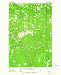
1961 Map of Neihart
USGS Topo · Published 1964About this map
Neihart serves as the central hub of this mountain survey, clustered along the banks of Belt Creek and surrounded by the steep terrain of the Lewis and Clark National Forest. The local economy of the early 1960s is clearly defined by its mineral history, with several named mining operations such as the Silver Dyke Mine, Cornucopia Mine, and Florence Mine situated on the slopes above the town. These workings, along with others like the Moulton Mine and Hartley Mine, trace the industrial development of the Little Belt Mountains. The landscape is a network of ridges and water sources, from the heights of Neihart Baldy and Pioneer Ridge down to the Neihart Reservoir. Natural landmarks like Memorial Falls and The Devils Chair provide unique geographic orientation points for the region, while a series of pack and jeep trails indicate the remote access routes used by foresters and miners alike.
Find a feature on this map
38 named features on this map. Tap any name to fly to it.
Don’t see what you’re looking for? This feature index may not catch every label — zoom into the map to look around manually.
Map Details
Editions of this 1961 Neihart Map
2 editions found
Other maps of this area

1886 · Little Belt Mts.
USGS Topo · 1:250,000

1890 · Fort Benton
USGS Topo · 1:250,000

1892 · Fort Benton
USGS Topo · 1:250,000

1894 · Little Belt Mts.
USGS Topo · 1:250,000

1897 · Fort Benton
USGS Topo · 1:250,000

1897 · Little Belt Mts.
USGS Topo · 1:250,000

1898 · Little Belt Mts.
USGS Topo · 1:250,000

1902 · Little Belt Mts.
USGS Topo · 1:250,000

1948 · White Sulphur Springs
USGS Topo · 1:250,000

1954 · Great Falls
USGS Topo · 1:250,000