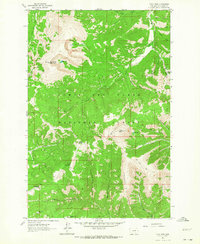
1961 Map of Yogo Peak
USGS Topo · Published 1964About this map
Lewis and Clark National Forest encompasses this high-altitude landscape in the Little Belt Mountains as it appeared in the early 1960s. The map highlights a series of prominent summits and ridges, including the namesake Yogo Peak, Big Baldy Mountain, and the massive Prospect Ridge that dominates the southeastern quadrant. Evidence of the region’s long-standing mining history is visible at the Neihart No 2 site near the western boundary, while the surrounding terrain is carved by a dense network of gulches such as Gravel Gulch, Lyons Gulch, and Lead Gulch.
Find a feature on this map
40 named features on this map. Tap any name to fly to it.
Don’t see what you’re looking for? This feature index may not catch every label — zoom into the map to look around manually.
Map Details
Editions of this 1961 Yogo Peak Map
3 editions found
Other maps of this area

1886 · Little Belt Mts.
USGS Topo · 1:250,000

1890 · Fort Benton
USGS Topo · 1:250,000

1892 · Fort Benton
USGS Topo · 1:250,000

1894 · Little Belt Mts.
USGS Topo · 1:250,000

1897 · Fort Benton
USGS Topo · 1:250,000

1897 · Little Belt Mts.
USGS Topo · 1:250,000

1898 · Little Belt Mts.
USGS Topo · 1:250,000

1902 · Little Belt Mts.
USGS Topo · 1:250,000

1948 · White Sulphur Springs
USGS Topo · 1:250,000

1954 · Great Falls
USGS Topo · 1:250,000