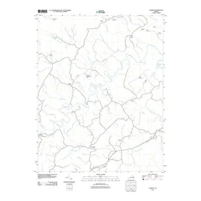
2010 Map of Charity
USGS Topo · Published 2010About this map
The Smith River winds through this rural landscape in the southern Virginia foothills, shaping the character of the small settlements at Charity and Elamsville. Long-standing family lineages are evident in the dense distribution of burial grounds, including the Thomas Cemetery, McAlexander Cemetery, Whorley Cemetery, and Rakes Cemetery, which dot the ridges and valleys between Shooting Creek and Puppy Creek. This 2010 survey highlights a community balancing its agricultural roots with local infrastructure, featuring the Bush Airport and the Outdoor Recreations Dam. To the east, the terrain rises toward Poor Mountain and the western edge of Philpott Lake, while the southeastern corner reaches the boundaries of Fairy Stone State Park. A notable architectural landmark is preserved at the Bob White Covered Bridge along the Smith River, serving as a rare remaining example of historic regional engineering amidst the modern road networks of Johnnys Ridge Rd and Deer Run Rd.
Find a feature on this map
48 named features on this map. Tap any name to fly to it.
Don’t see what you’re looking for? This feature index may not catch every label — zoom into the map to look around manually.
Map Details
Editions of this 2010 Charity Map
This is the sole edition of this map. No revisions or reprints were ever made.
Other maps of this area

1926 · Critz
USGS Topo · 1:48,000

1928 · Stuart
USGS Topo · 1:48,000

1928 · Critz
USGS Topo · 1:62,500

1931 · Stuart
USGS Topo · 1:62,500

1953 · Winston-Salem
USGS Topo · 1:250,000

1955 · Winston-Salem
USGS Topo · 1:250,000

1957 · Endicott
USGS Topo · 1:62,500

1957 · Floyd
USGS Topo · 1:62,500

1962 · Winston-Salem
USGS Topo · 1:250,000

1967 · Patrick Springs
USGS Topo · 1:24,000