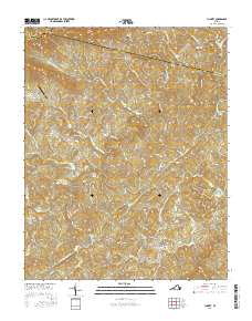
2016 Map of Charity
USGS Topo · Published 2016About this map
The Smith River and its numerous tributaries, including Joint Crack Cr and Goblintown Cr, carve a complex drainage pattern through this corner of Patrick County. The landscape is dotted with small family and community burial grounds such as Goblintown Cem, McAlexander Cem, and the Rakes-Thomas Cem, providing essential markers for genealogical research in the communities of Charity and Elamsville. A notable cultural landmark, the Bob White Covered Bridge, spans the river in the southwest, while the northern heights are defined by Poor Mtn and the prominent Chimney Rock near the Floyd County line.
Find a feature on this map
88 named features on this map. Tap any name to fly to it.
Don’t see what you’re looking for? This feature index may not catch every label — zoom into the map to look around manually.
Map Details
Editions of this 2016 Charity Map
This is the sole edition of this map. No revisions or reprints were ever made.
Other maps of this area

1926 · Critz
USGS Topo · 1:48,000

1928 · Stuart
USGS Topo · 1:48,000

1928 · Critz
USGS Topo · 1:62,500

1931 · Stuart
USGS Topo · 1:62,500

1953 · Winston-Salem
USGS Topo · 1:250,000

1955 · Winston-Salem
USGS Topo · 1:250,000

1957 · Endicott
USGS Topo · 1:62,500

1957 · Floyd
USGS Topo · 1:62,500

1962 · Winston-Salem
USGS Topo · 1:250,000

1967 · Patrick Springs
USGS Topo · 1:24,000