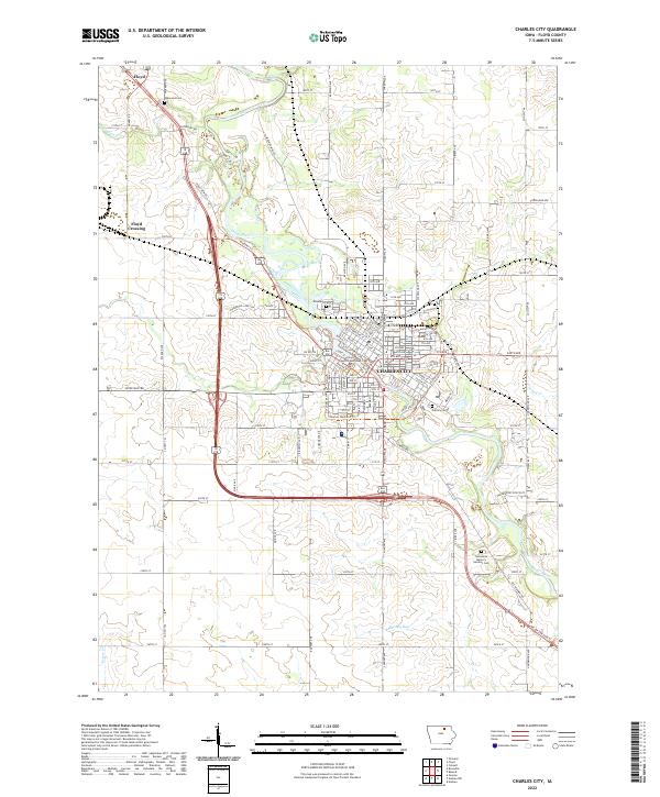
2022 Map of Charles City
USGS Topo · Published 2022About this map
The Cedar River defines the landscape of central Floyd County, Iowa, as it winds past the northern settlement of Floyd and the larger industrial and residential hub of Charles City. This river-centric topography is marked by several smaller tributaries, including Stewart Cr and the descriptively named Bloody Run to the south. The urban layout of the county seat is anchored by the Floyd County Courthouse, with neighborhoods spreading along streets like N Main St and Ferguson St.
Find a feature on this map
110 named features on this map. Tap any name to fly to it.
Don’t see what you’re looking for? This feature index may not catch every label — zoom into the map to look around manually.
Map Details
Editions of this 2022 Charles City Map
This is the sole edition of this map. No revisions or reprints were ever made.
Other maps of this area

1954 · Mason City
USGS Topo · 1:250,000

1954 · Waterloo
USGS Topo · 1:250,000

1955 · Waterloo
USGS Topo · 1:250,000

1957 · Mason City
USGS Topo · 1:250,000

1958 · Mason City
USGS Topo · 1:250,000

1971 · Orchard
USGS Topo · 1:24,000

1971 · Charles City
USGS Topo · 1:24,000

1971 · Nashua NW
USGS Topo · 1:24,000

1971 · Bassett
USGS Topo · 1:24,000

1971 · Colwell
USGS Topo · 1:24,000