
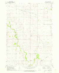
1971 Map of Orchard
USGS Topo · Published 1973About this map
The Cedar River meanders sharply through this North Iowa landscape, marking the transition from the rolling uplands of West Lincoln and Cedar townships into the northern reaches of Floyd. The small community of Orchard serves as a central point of interest, situated near the Illinois Central railroad line. This 1971 field-checked survey highlights a predominantly agricultural region interspersed with significant conservation and recreational areas, including Idlewild State Park and a State Wildlife Management Area along the riverbanks. Local history and genealogy are well-preserved through detailed locations of several rural burial grounds such as Tucker Cem, Dudley Cem, and Calvary Cem. The landscape is also marked by small-scale industrial activity, evidenced by a Quarry and various Quarries located near the drainage of Skunk Creek and Rock Creek.
Find a feature on this map
21 named features on this map. Tap any name to fly to it.
Don’t see what you’re looking for? This feature index may not catch every label — zoom into the map to look around manually.
Map Details
Editions of this 1971 Orchard Map
This is the sole edition of this map. No revisions or reprints were ever made.
Other maps of this area

1954 · Mason City
USGS Topo · 1:250,000

1957 · Mason City
USGS Topo · 1:250,000

1958 · Mason City
USGS Topo · 1:250,000

1971 · Rockford
USGS Topo · 1:24,000

1971 · Rudd
USGS Topo · 1:24,000

1971 · Charles City
USGS Topo · 1:24,000

1971 · Floyd
USGS Topo · 1:24,000
1971 · Roseville
USGS Topo · 1:24,000

1972 · Osage
USGS Topo · 1:24,000

1972 · New Haven
USGS Topo · 1:24,000