
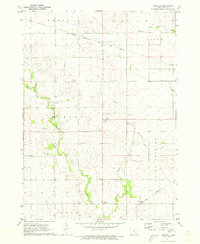
1971 Map of Rudd
USGS Topo · Published 1973About this map
Rudd and Nora Springs anchor this 1970s survey of the north-central Iowa prairie, where the Chicago Milwaukee St Paul and Pacific railroad cuts a straight line through the agricultural heartland. The landscape is defined by the winding courses of the Shell Rock River, Rock Creek, and Flood Creek, which carve through the grid-patterned fields of Cedar, Rock Grove, and Rudd townships. This era of the map shows a developed rural infrastructure, with a Quarry and Sandpit indicating local industry alongside recreational spaces like Roadside Park and the riverfront Picnic Area. For genealogists, the map provides precise locations for several local burial sites and gathering places, including Eden Cem, Evergreen Cem, and the nearby Eden Ch. The survey captures the region just as the interstate system began to bypass these smaller rail-dependent communities.
Find a feature on this map
19 named features on this map. Tap any name to fly to it.
Don’t see what you’re looking for? This feature index may not catch every label — zoom into the map to look around manually.
Map Details
Editions of this 1971 Rudd Map
This is the sole edition of this map. No revisions or reprints were ever made.
Other maps of this area

1954 · Mason City
USGS Topo · 1:250,000

1957 · Mason City
USGS Topo · 1:250,000

1958 · Mason City
USGS Topo · 1:250,000

1959 · Mason City
USGS Topo · 1:62,500

1959 · Nora Springs
USGS Topo · 1:24,000

1959 · Mason City SE
USGS Topo · 1:24,000

1971 · Rockford
USGS Topo · 1:24,000

1971 · Orchard
USGS Topo · 1:24,000
1971 · Roseville
USGS Topo · 1:24,000

1972 · Osage
USGS Topo · 1:24,000