
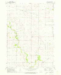
1971 Map of Floyd
USGS Topo · Published 1973About this map
The Little Cedar River meanders through this north-central Iowa landscape, defining the character of Cedar and Floyd townships. In the early 1970s, the settlement of Floyd serves as a local hub at the intersection of rail and river, while the small community of Howardville sits further north along the county line. The land use reveals a mix of agricultural tradition and industrial resource extraction, evidenced by numerous Gravel Pits, a Sandpit, and a Quarry near the riverbanks.
Find a feature on this map
19 named features on this map. Tap any name to fly to it.
Don’t see what you’re looking for? This feature index may not catch every label — zoom into the map to look around manually.
Map Details
Editions of this 1971 Floyd Map
This is the sole edition of this map. No revisions or reprints were ever made.
Other maps of this area

1954 · Mason City
USGS Topo · 1:250,000

1957 · Mason City
USGS Topo · 1:250,000

1958 · Mason City
USGS Topo · 1:250,000

1971 · Orchard
USGS Topo · 1:24,000

1971 · Charles City
USGS Topo · 1:24,000

1971 · Bassett
USGS Topo · 1:24,000

1971 · Colwell
USGS Topo · 1:24,000
1971 · Roseville
USGS Topo · 1:24,000

1972 · Osage
USGS Topo · 1:24,000

1972 · New Haven
USGS Topo · 1:24,000